
Elevation Survey for Designing a Waterfront Clubhouse Site
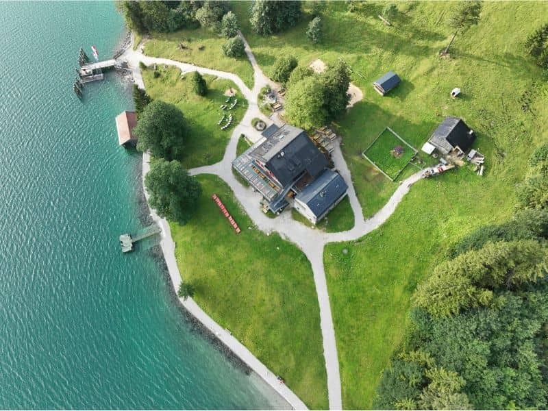
The lake view sells the clubhouse, but the water level decides where it can safely sit, and an elevation survey is the most reliable way to know that number before design starts. Waterfront sites slope, flood, and shift in ways a site visit won’t show. A clubhouse placed a few feet too low can face flood damage, insurance trouble, or a long fight with permit reviewers. Developers, HOAs, and club boards should get accurate elevations first, then let the architect chase the view.
Assessing Ground Elevations and Existing Waterfront Site Conditions
Start by mapping the ground from the road down to the water. Your surveyor collects spot elevations, contours, and grade breaks across the whole site. The shoreline, normal water level, and any marks from past high water should be on the map too.
Expect the survey to show these features:
- Top and toe of banks along the shoreline
- Existing docks, seawalls, ramps, and boathouses
- Trees, rock outcrops, and wet areas
- Roads, parking, and existing buildings
- Utility lines, septic areas, and drainage paths
Lakes managed by a utility or agency often have their own shoreline rules . Some set a boundary at a certain elevation or limit what can be built near the water. Ask the managing agency about those rules early, and share them with your surveyor.
Determining Suitable Clubhouse Placement Based on Survey Elevation Data
Elevation data shows where the clubhouse can sit high enough and still feel close to the water. The best view is often on the lowest ground, which is also the riskiest spot. Your designer can use the elevation survey to compare a few locations side by side.
Moving the building uphill by 30 or 40 feet can change its flood risk a lot. It can also cut down on fill, retaining walls, and foundation costs. Those savings often outweigh losing a few feet of shoreline frontage .
Placement also depends on setbacks, easements, and shoreline rules. A spot that looks perfect on the topo may sit inside a buffer or a utility easement. Check those limits with the planning office and lake authority before picking a final site.
Planning Finished Floor Elevations and Floodplain Considerations
Floor height is where the survey matters most. If the site is in a mapped flood zone, the community’s floodplain rules will set a minimum height for the lowest floor. Some communities require floors to sit a set distance above the base flood elevation.
Your surveyor ties the site to the same elevation datum used on the flood map. That lets the engineer compare the ground directly to the flood numbers. Without that tie, a floor height could look safe on paper and still fall short.
Plan for paperwork too. Many projects in flood zones need an elevation certificate during or after construction, and lenders or insurers may ask for one. Ask your floodplain administrator what’s required before you lock in the floor height, since an accurate elevation survey now makes that process much easier later.
Designing Walkways, Outdoor Amenities, and Accessible Building Entrances
The clubhouse rarely stands alone. Patios, pool decks, fire pits, and walkways down to the docks all need grades that work. Elevations show how much drop each path has to cover.
Accessible routes need extra care. Ramps and walks that serve accessible entrances have slope limits under accessibility standards. Survey data helps the designer find routes that meet those limits without long switchbacks.
Think about how amenities handle high water. A lower patio or lawn may flood now and then, and that can be fine if it’s planned for. Keep electrical equipment, pool systems, and storage above the expected flood level.
Using Elevation Survey Measurements for Grading and Drainage Planning
Waterfront sites need drainage that protects both the building and the lake. Runoff from roofs and pavement carries silt and other material toward the shoreline. The engineer uses survey grades to slow that water and send it through swales, rain gardens, or other controls.
Watch for water coming from uphill. Roads and neighboring lots can send runoff across the site during heavy storms. The survey shows where that water enters so the plan can route it around the clubhouse.
Erosion near the shore needs its own plan. Steep banks and bare soil wash out fast during construction. Ask your engineer how the grading plan protects the shoreline, and confirm what erosion control permits apply.
Frequently Asked Questions
Why is an elevation survey needed before designing a waterfront clubhouse?
Waterfront sites have slopes, water levels, and flood risks that change what you can build. Accurate elevations show where the building can sit safely. They also help the engineer meet floodplain rules and plan drainage. Without them, design changes and permit delays are common.
How does an elevation survey help determine the best clubhouse location?
The survey shows high ground, low spots, and how the site slopes toward the water. Designers can compare several building spots using real numbers. A slightly higher location often lowers flood risk and construction costs. Setbacks and shoreline rules still need to be checked for each option.
Can an elevation survey help establish finished floor heights near a lake?
Yes, the survey ties site elevations to the same datum used on flood maps. That lets the engineer set a floor height that meets local floodplain rules. Some communities require the floor to sit above the base flood elevation by a set amount. Confirm the requirement with your floodplain administrator before design is final.
What elevation information is needed for waterfront walkways and outdoor amenities?
You’ll need spot elevations along proposed paths, patios, and dock connections. Contours and grade breaks help the designer plan slopes and steps. Accessible routes need enough detail to check ramp and walk slopes. High-water marks help decide which amenities can handle occasional flooding.
How does an elevation survey support drainage and floodplain planning?
The survey shows how water moves across the site and toward the lake. Engineers use it to plan swales, inlets, and erosion controls. It also helps compare ground levels with flood zone elevations. A current elevation survey gives both the design team and reviewers the numbers they need.
